

posted on October 21, 2023
This site contains affiliate links, which means we may earn a small commission if you make a purchase through our links, at no extra cost to you. Thank you for supporting this website! For more information, please visit our disclosure page.
Are you eager to discover the stunning landscapes of Banff National Park? Whether you’re a novice hiker or an experienced trekker seeking a more leisurely outing, this comprehensive guide to easy hikes in Banff has all the information you need.
We’ve compiled a list of the most rewarding day hikes in Banff, complete with detailed descriptions, photos, and trail information—so you can enjoy the Canadian Rockies, regardless of your hiking experience!
From the Lake Louise Lakeshore Trail to the hike leading to the Johnston Canyon waterfalls, we present our comprehensive list of the 23 best easy hikes in Banff. These trails will take you through the park’s breathtaking mountain views, crystal-clear alpine lakes, and towering pine forests.
Along with recommending short hikes, we also address common questions about what to pack for your journey, the best times to explore the outdoors, and how to prepare for your hiking experience in this stunning national park.
First time visiting Banff? Check out these travel resources that will simplify your planning:
→ eSIM: Knowroaming and Airalo offer affordable Canada data plans.
→ VPN: Enhance your privacy and internet security with NordVPN.
→ Car rental: Discover Cars helps you find the best car rental deals.
→ Flights: Search for competitive prices on Expedia!
→ Hotels: Expedia typically has great rates (plus, members enjoy extra rewards!). Don’t forget to check Tripadvisor for additional price comparisons. Further down, you’ll find our hotel recommendations in the area.
→ Food: Savor the culinary delights in Banff with our food guide.
→ Visiting in winter? Follow our one-day winter itinerary for Banff!
→ Hiking in Jasper? Be sure to check out the top easy hikes in Jasper!

Can you hike in Banff?
Absolutely! Hiking in Banff is a fantastic experience, which is likely why you’re reading this post.
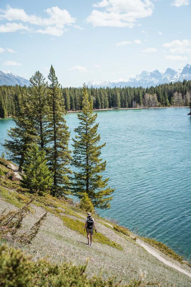
The breathtaking mountains surrounding Banff and Lake Louise offer adventurers world-class hiking trails to explore.
With over 1,600 km (1,000 miles) of trails available, many of the park’s most renowned hikes are easily accessible from the Town of Banff and the village of Lake Louise!
Is it safe to hike in Banff?
Yes, hiking can be safe in Banff as long as you exercise caution. The wilderness can present dangers, and even short trips away from the Town of Banff can lead to serious situations.
Here are some tips to ensure your safety and preparedness during your hiking adventures:
- Check the weather forecast before heading out; however, be prepared for sudden changes, as mountain weather can shift quickly. Dress in layers and carry extra food and warm clothing.
- Review trail descriptions and maps carefully before starting your hike. Always choose trails that are suitable for the least experienced person in your group.
- Download the AllTrails app to navigate Banff’s hiking trails like a pro. It provides trail information, maps, and reviews to help you prepare for your hikes, and you can download maps for offline use.
- Be aware that some trails may have lingering snow until late summer, which can complicate navigation and make them unsafe. Always check trail conditions.
- Trails above the tree line (2,000 m / 6,561 ft) are susceptible to avalanches year-round, especially during winter from November to June. Always check the Avalanche Bulletin for current conditions before heading out.
- Check for any warnings and closures before you set out on your hike.
- Bring your own water, as drinking untreated surface water can be hazardous.
- Carry a first aid kit.
- Avoid using earbuds or headphones to remain aware of your surroundings.
- Inform someone you trust about your plans, including your route, expected return time, and any contact information in case you don’t return.
- Be aware that ticks that can carry Lyme disease may be present in the park; check yourself and your pets for ticks after hiking.
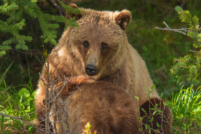
And let’s not forget that Banff National Park is home to abundant wildlife, including elk, wolves, cougars, grizzly bears, and black bears. You could encounter wildlife anywhere in the park, even on paved paths or roads.
To remain safe while hiking in Banff, follow these guidelines:
- Carry bear spray and know how to use it. Bear spray can be purchased at visitor centers and retail stores in Banff and Lake Louise.
- Make noise while you hike to alert animals to your presence.
- If bringing dogs, keep them on a leash at all times.
- If you spot wildlife, keep a safe distance of at least 30 m (98 ft) from elk and deer, and 100 m (328 ft) from bears, wolves, cougars, and coyotes. Never approach wildlife for photos.
Important note: In spring, be especially cautious if you encounter a bear. Avoid accidentally getting between a mother bear and her cubs!
How we selected our easy hikes in Banff
With hundreds of hiking trails in Banff and Lake Louise, how did we choose the 23 best easy hikes to feature in this article?
We evaluate several criteria:
First, we focus on trails that are easily accessible and straightforward to find.
Next, we ensure that the trails can be completed within a day, with most being short enough to finish in less than half a day.
Additionally, we prioritize trails that provide stunning views or opportunities to engage with wildlife (from a safe distance, of course) for a memorable experience.
Top 23 Easy Hikes in Banff
Put on your hiking boots, grab your water bottle, and prepare to explore some of Banff’s finest hikes!
With breathtaking views of glacial lakes, cascading waterfalls, and soaring mountain peaks, Banff National Park is a true paradise for hikers.
Each of the following 23 easy hikes offers its own unique beauty and adventure, from the tranquil Johnston Canyon to the scenic Lake Minnewanka.
Ready? Let’s hit the trails and discover the wonders of Banff National Park together!
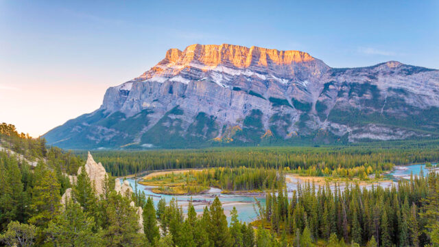
⛰️Johnson Lake
▻ Distance: 3 km / 1.8 mi loop
▻ Type: loop
▻ Duration: 45 min to 1 hr
▻ Elevation: 30 m / ~100 ft
▻ Accessibility: year-round; wear microspikes if it is snowy or icy
▻ Trailhead: Johnson Lake day-use area
▻ Click here for trail map
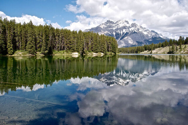
The Johnson Lake loop trail features captivating sunset views. The trail circles Johnson Lake with the majestic Mount Rundle in the background.
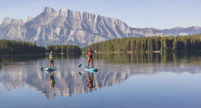
⛰️Two Jack Lake
▻ Distance: 1.6 km / 1 mi one way
▻ Type: out and back
▻ Duration: 30 min to 1 hr one way
▻ Elevation: 184 m / 603 ft
▻ Accessibility: year-round
▻ Trailhead: park at the Two-Jack day-use area; the trail begins at the southern end of the parking lot (near the restroom).
▻ Click here for trail map
While exploring Lake Minnewanka Scenic Drive, don’t miss the Two Jack Lake trail—short treks with unobstructed views of the gorgeous lake and surrounding peaks.
Consider bringing a picnic or a BBQ for a lakeside meal. If you’re up for some fun in the water, you can fish (with a license), take a dip, or rent a kayak or paddleboard for a calm day out on the lake.
⛰️Bankhead (Bankside) Historical Loop
▻ Distance: 1.1 km / 0.68 mi
▻ Type: Loop
▻ Elevation: 35 m / 115 ft
▻ Duration: ~35 min
▻ Accessibility: June to October
▻ Trailhead: at the far-right end of the fence near the entrance of the Lower Bankhead parking lot, along the Lake Minnewanka Loop
Click here for trail map
This scenic loop hike showcases vibrant wildflowers and weaves through the remnants of the ghost town Bankhead, which was a coal mining hub in the early 1900s.
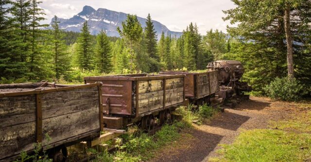
Follow the interpretive trail to explore abandoned buildings and mining carts. The trail’s educational plaques make it feel like a museum, providing an enriching and informative experience.
With minimal elevation gain, this leisurely stroll feels more akin to a walk in Banff.
⛰️Stewart Canyon
▻ Distance: 3.3 km / 2 mi one way
▻ Type: out and back
▻ Duration: 1.5 hrs one way
▻ Elevation: 250 m / 820 ft
▻ Accessibility: year-round
▻ Trailhead: Lake Minnewanka day-use area – look for the information kiosk at the far end of the picnic area
Click here for trail map
The Stewart Canyon hike starts along the shores of beautiful Lake Minnewanka! After a gentle beginning, the trail leads you over a wooden bridge spanning Stewart Canyon.
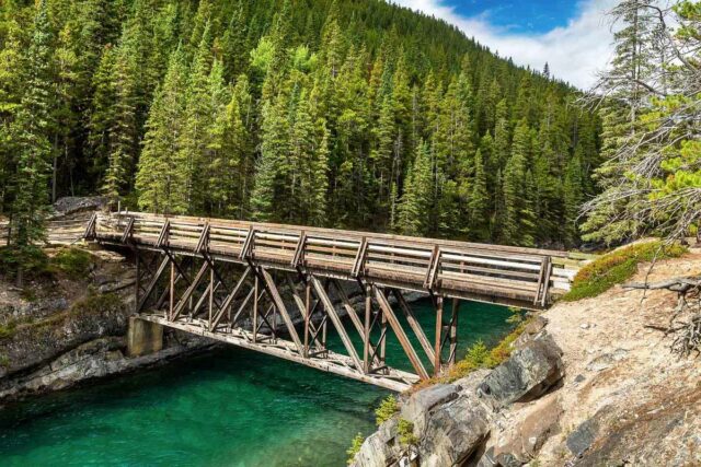
Keep in mind that this area is grizzly territory; during berry season (July-September), it’s best to hike in groups of at least four and carry bear spray!
The trail becomes a little more challenging in the canyon, with rocks, roots, and occasional fallen trees, but it remains manageable. Following the cascading river for about 2 km (1.24 mi) offers great chances for wildlife spotting and scenic river views!
⛰️Tunnel Mountain Hoodoos Trail
▻ Distance: 10 km / 6.2 mi loop
▻ Type: loop
▻ Duration: 2.5 to 3.5 hrs
▻ Elevation: 316 m / 1,036 ft
▻ Accessibility: year-round
▻ Trailhead: Surprise Corner parking lot
Click here for trail map
This Tunnel Mountain hike begins at the Surprise Corner parking lot, where stunning views of the iconic Fairmont Banff Springs Hotel await you.
As you follow the dirt path, you’ll reach the shores of the Bow River, with breathtaking views of the impressive Mount Rundle.
After a climb up some stairs, you’ll reach a bench atop Tunnel Mountain, where several viewpoints showcase the hoodoos—unique rock formations that will surprise you outside a desert setting! Be on the lookout for interpretive exhibits regarding the formation of these gargoyle-like hoodoos.
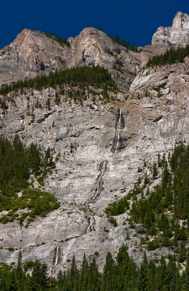
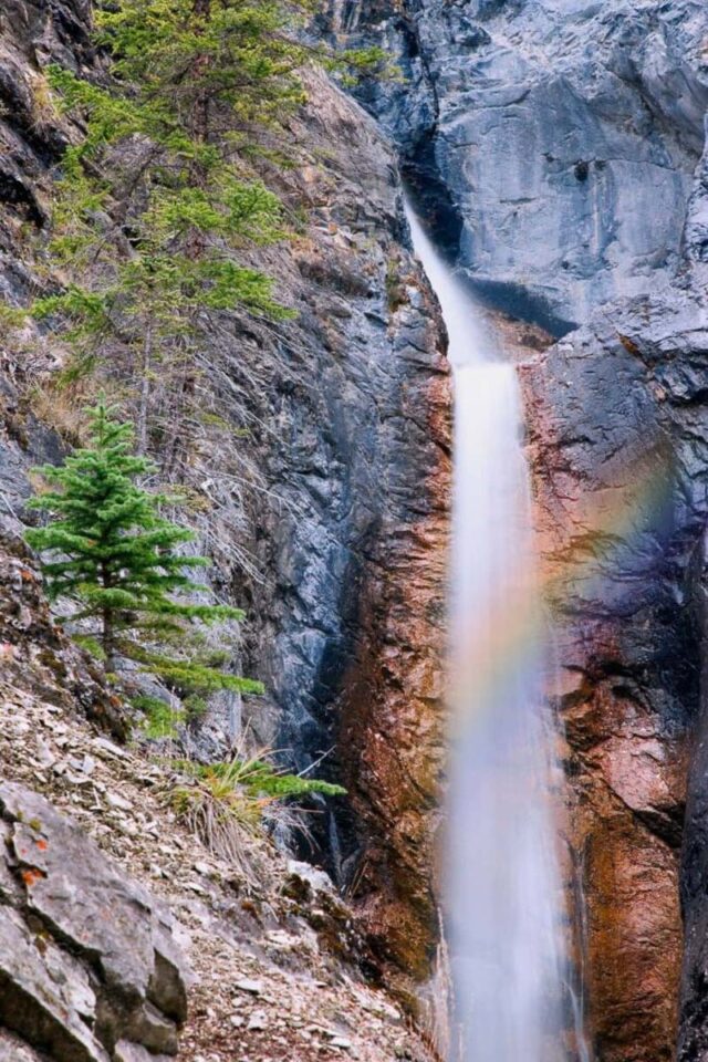
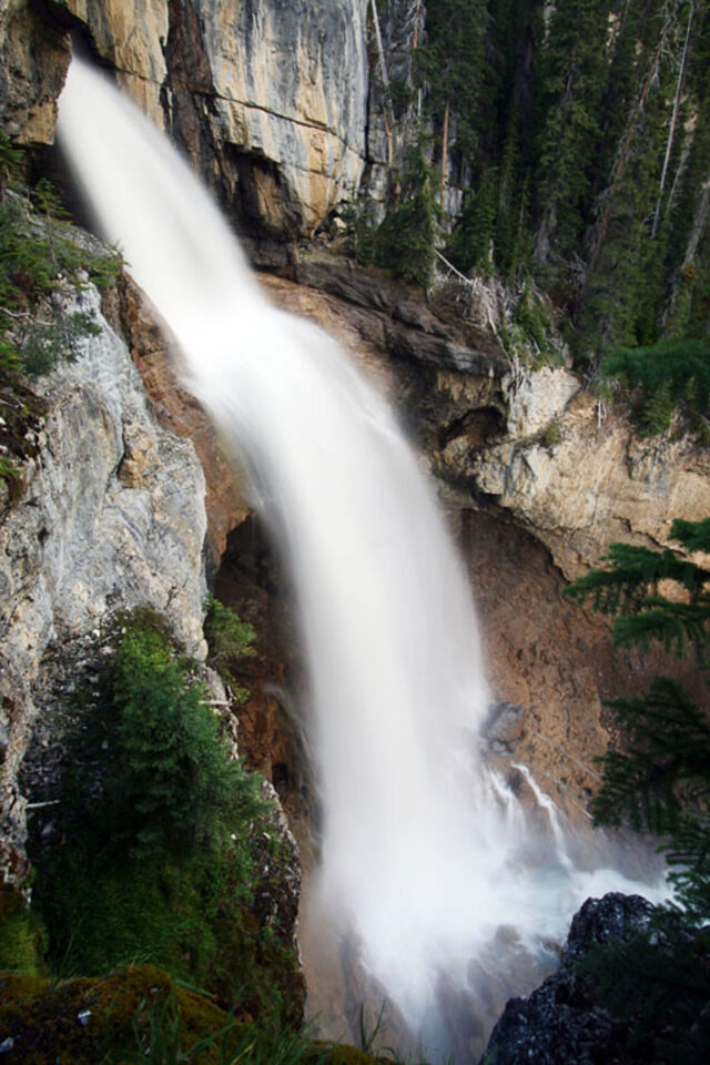
⛰️Cascade Falls
▻ Distance: 0.65 km / 0.4 mi one way
▻ Type: out and back
▻ Duration: 30 min one way
▻ Elevation: 144 m / 473 ft
▻ Accessibility: May to October
▻ Trailhead: Banff Airfield Parking
Click here for trail map
Engage with nature on one of the best hikes in Banff—a journey to the spectacular Cascade Falls! Standing beside the impressive 300 m (984 ft) waterfall will leave you breathless!
While the hike is short, be prepared for a steep incline. Watch out for loose shale rocks as you make your way up the mountain.
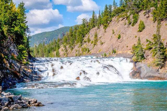
⛰️Bow Falls Viewpoint
▻ Distance: 1.2 km / 0.75 mi one way
▻ Type: out and back
▻ Duration: 30 min one way
▻ Elevation: 66 m / 216 ft
▻ Accessibility: year-round
▻ Trailhead: located in the Town of Banff, right at the southern base of the pedestrian bridge over Bow River
Click here for trail map
The trail is mostly flat but contains sections with wooden stairs to navigate. Despite being busy with visitors, it leads to a platform with stunning views of Bow Falls—a sight that’s breathtaking any time of year!
This trail is conveniently within walking distance from the town center.
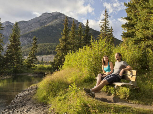
⛰️Spray River Loop
▻ Distance: 12 km / 7.5 mile loop
▻ Type: loop
▻ Duration: 3.5 to 5 hrs
▻ Elevation: minimal
▻ Accessibility: March to October
▻ Trailhead: park at the Bow Falls day-use area and start your loop either from Golf Course Road, which is located at the end of the 15th hole as you cross the bridge, or from the parking area behind the Fairmont Banff Springs hotel (if you’re staying there).
Click here for trail map
Discover the beauty of Spray River on one of the top-rated walking trails in Banff!
Along the route, you’ll encounter breathtaking clearings that provide stunning views to remember, with the river’s crystal-clear blue waters always within sight!
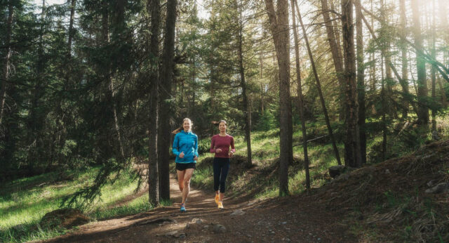
⛰️Fenland Trail
▻ Distance: 2.1 km / 1.25 mi loop
▻ Type: Loop
▻ Duration: 40 min
▻ Elevation: none
▻ Accessibility: year-round
▻ Trailhead: located at the parking lot next to Mt. Norquay Road, diagonally opposite the Fenland Banff Recreation Center.
Click here for trail map
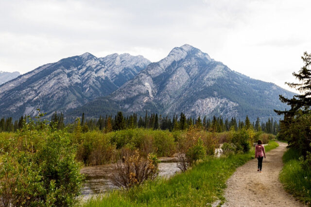
This short trail offers excellent opportunities to spot wildlife like elk, along with stunning views of the Canadian Rockies through the trees lining the path.
If you feel up for a slightly longer hike, you can continue along the flat trail leading to Vermillion Lakes.
⛰️Marsh Loop
▻ Distance: 2.8 km / 1.74 mi loop
▻ Type: loop
▻ Duration: 1 hr
▻ Elevation: minimal
▻ Accessibility: June to October
▻ Trailhead: follow the paved walkway near the Cave and Basin National Historic Site until you find the trailhead kiosk.
Click here for trail map
The most scenic part of the trail runs along the Bow River, providing ample opportunities to spot wildlife such as moose and bears!
Be aware that due to its popularity with horse riders, the trail may be muddy and occasionally target practice for horse droppings!
⛰️Sulphur Mountain Boardwalk
▻ Distance: 1 km / 0.6 mi one way
▻ Type: out and back
▻ Duration: 30 min one way
▻ Elevation: 35 m / 115 ft
▻ Accessibility: year-round; wear microspikes in winter as it can be icy
▻ Trailhead: Sulphur Mountain Gondola upper terminal (a ticket for the gondola ride is required)
Click here for trail map
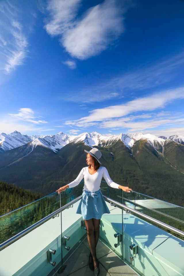
This boardwalk ranks among our favorite easy hikes in Banff.
Beginning at the upper terminal of the Sulphur Mountain Gondola, the trail winds its way up to Sanson’s Peak, offering stunning views of the surrounding landscape as you traverse the ridge along the north side of Sulphur Mountain.
At the summit, you will be welcomed by the Sulphur Mountain Cosmic Ray Station, a designated National Historic Site of Canada.
⛰️Sunshine Meadows
▻ Distance: 1 to 10 km / 0.6 to 6.2 mi loop
▻ Type: loop
▻ Duration: 1 to 2 hrs or a full day
▻ Elevation: 49 to 176 m / 160 to 577 ft
▻ Accessibility: June to September
▻ Trailhead: ride the gondola at Banff Sunshine Ski Resort to the Village to start your hike. Alternatively, continue on to ride the Standish Chairlift for an even higher starting point.
Click here for trail map
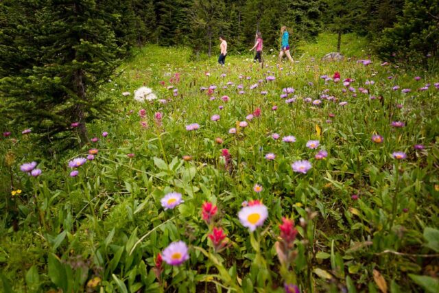
The Sunshine Meadows hike features a broad network of trails (10 km / 6.2 mi) with varied difficulties, ranging from easy to moderate.
You’ll be captivated by expansive views of blooming alpine meadows and vibrant wildflowers, as you explore three distinct alpine lakes: Rock Isle Lake, Larix Lake, and Grizzly Lake.
If you’re short on time, head directly to Rock Isle Lake. This picturesque lake is easily accessible from the Standish viewing deck and is in close proximity to Sunshine Village.
⛰️Johnston Canyon
▻ Distance: Lower Falls: 1.2 km / 0.75 mi one way, Upper Falls: 2.5 km / 1.5 mi one way
▻ Type: out and back
▻ Duration: 1 to 1.5 hrs one way
▻ Elevation: Lower falls: 50 m / 164 ft, Upper falls: 120 m / 394 ft
▻ Accessibility: year-round; summer brings crowds, while winter transforms it into an icy walk to frozen waterfalls
▻ Trailhead: northern end of Johnston Canyon parking lot
Click here for trail map
In summer, Johnston Canyon sees throngs of visitors, but winter offers a unique experience with the waterfalls beautifully frozen. The sight of the icy cascades is awe-inspiring.
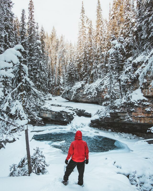
You can hike to either the lower or upper falls, or if you’re feeling adventurous, continue on to the ink pots (an additional 3 km / 1.8 mi)!
Important Note: In May, June, and September, the 17 km (10.5 mi) stretch of Bow Valley Parkway from Banff to Johnston Canyon is closed to motorized traffic, exclusively for cyclists.
If you plan to visit during these months, consider joining a tour, biking, or driving from Lake Louise to reach this beautiful destination.
⛰️Silverton Falls
▻ Distance: 0.8 km / 0.5 mi one way
▻ Type: out and back
▻ Duration: 30 mins one way
▻ Elevation: 87 to 106 m / 282 to 348 ft
▻ Accessibility: year-round
▻ Trailhead: Rockbound Lake trailhead parking lot
Click here for trail map
Silverton Falls is undoubtedly one of the most stunning and easy hikes in Banff.
This trail, adorned with beautiful waterfalls, is suitable for hikers of all levels and tends to be less crowded, making it a perfect getaway to enjoy nature.
The path starts relatively flat through a serene forest but soon leads to a breathtaking viewpoint overlooking a stunning two-tiered waterfall!
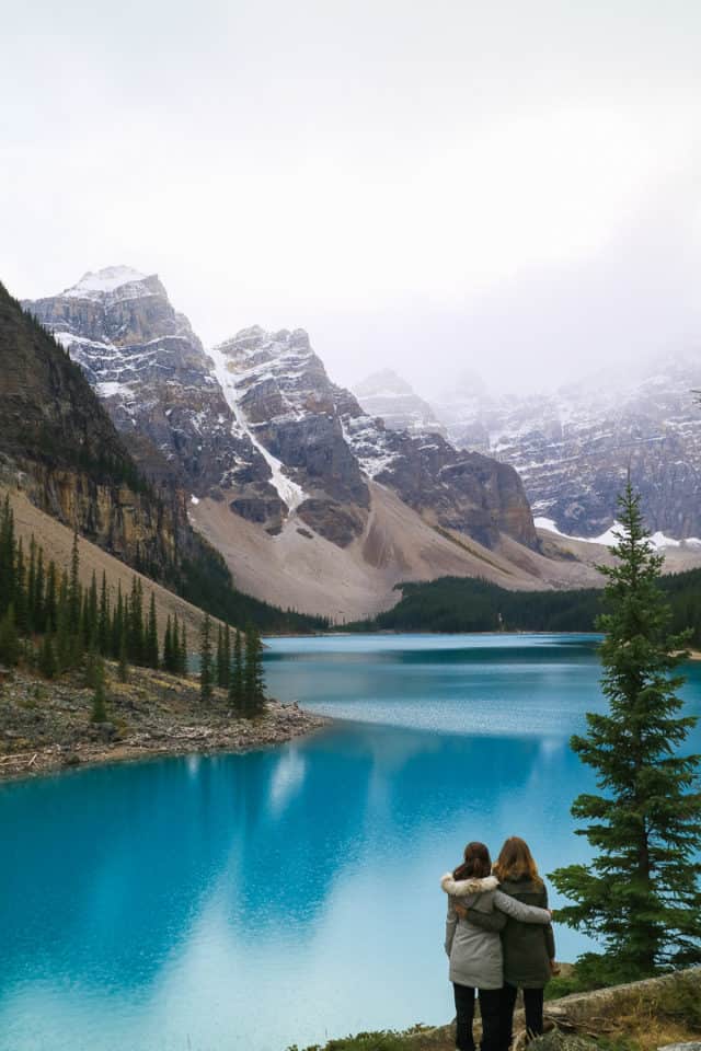
⛰️Moraine Lake Rockpile Trail
▻ Distance: 400 m / 0.25 mi one way
▻ Type: out and back
▻ Duration: 20 min one way
▻ Elevation: 30 m / 98 ft
▻ Accessibility: June to October
▻ Trailhead: cross the bridge at the lower end of the Moraine Lake parking lot
Click here for trail map
The Moraine Lake trail leads you up steep rock-built stairs, but trust us, the view from the top is absolutely breathtaking. The Valley of the Ten Peaks towers over the stunning Moraine Lake, providing one of the most magnificent mountain views you’ll ever see.
Fun fact: This is the spot where the back of an older Canadian twenty-dollar bill was photographed. Be sure to bring your camera, as there are numerous viewpoints at the top for picture-perfect moments!
Many hikers combine this trail with the Lakeshore Trail (2.9 km / 1.8 mi return) or the Consolation Lakes Trail (6 km / 3.7 mi return).
Note: Moraine Lake becomes extremely crowded during summertime. Due to limited parking, we highly suggest using public transportation to access the area.
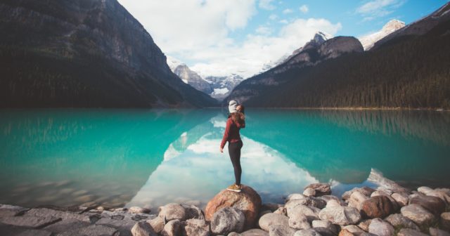
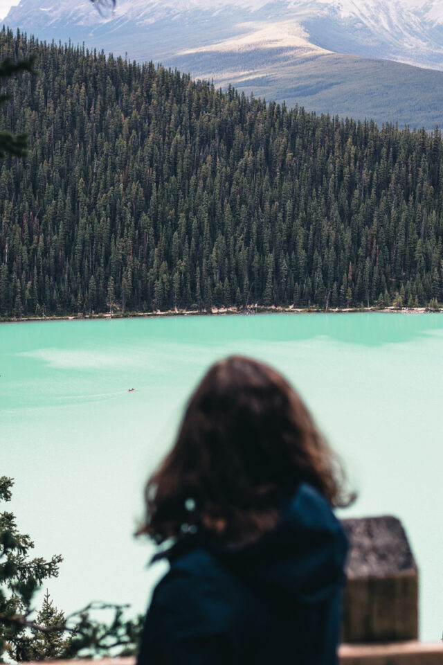
⛰️Lake Louise Shoreline Trail
▻ Distance: 2.25 km / 1.4 mi one way
▻ Type: out and back
▻ Duration: 35 min one way
▻ Elevation: Minimal
▻ Accessibility: year-round
▻ Trailhead: starts in front of the Fairmont Chateau Lake Louise hotel
Click here for trail map
Enjoy a relaxing stroll on this flat, easy trail that runs alongside Lake Louise, soaking in the beautiful landscape of water and mountain peaks.
You can walk to the end of the lake where the Victoria Glacier deposits rock silt, giving the lake its famous emerald color. And don’t miss the picturesque image of Fairmont Chateau Lake Louise in the background!
Feeling adventurous? Take the short hike uphill to the world-renowned back-of-the-lake climbing area, a favorite among avid rock climbers!
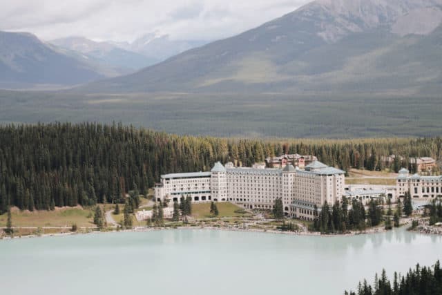
⛰️The Fairview Lookout Trail
▻ Distance: 1.2 km / 0.75 mi one way
▻ Type: out and back
▻ Duration: 30 min one way
▻ Elevation: 165 m / 540 ft
▻ Accessibility: year-round
▻ Trailhead: Upper Lake Louise Parking Area
Click here for trail map
The Fairview Lookout trail presents spectacular views of Lake Louise and the Fairmont Chateau Lake Louise hotel! Although there are some climbs along the way, this short hiking trail provides a preferable alternative to the more popular Lake Agnes Teahouse or Plain of Six Glaciers trail.
Plus, you get to enjoy a fantastic view that other trails may not offer due to tree cover!
⛰️Hector Lake (Icefields Parkway)
▻ Distance: 2.5 km / 1.55 mi one way
▻ Type: out and back
▻ Duration: 45 min one way
▻ Elevation: 100 m / 328 ft
▻ Accessibility: year-round
▻ Trailhead: Hector Lake Pull Off. Look for a small wooden sign that reads, “Hector Lake Hike”
Click here for trail map
Hector Lake is a hidden gem nestled at the border of Banff and Yoho National Park! Surrounded by stunning views of the Waputik Range, it offers a peaceful escape with spectacular mountain vistas.
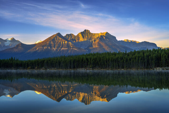
The often-overlooked trailhead allows for a tranquil retreat away from crowds. At the end of the trail, there is a campsite with canoes available for use.
Bring water shoes or sandals to cross the river, as the rocks can be slippery, but it’s definitely worth the adventure! Ensure your valuables are securely stored in your backpack since the current can be quite strong!
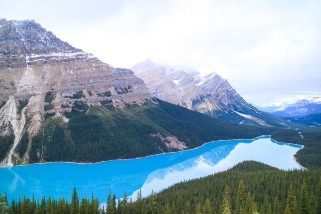
⛰️Peyto Lake Lookout Trail (Icefields Parkway)
▻ Distance: 2.6 km / 1.6 mi loop
▻ Type: loop
▻ Duration: 45 min to 1 hr
▻ Elevation: 80 m / 262 ft
▻ Accessibility: May to October
▻ Trailhead: Bow Summit parking lot
Click here for trail map
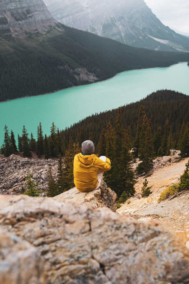
The hike to the enchanting Peyto Lake is a must on any Canadian Rockies itinerary. This trail offers one of the finest views of the vibrant blue glacier lake.
The main viewpoint is spectacular but it can get crowded; for a quieter experience, consider visiting the upper viewpoint, which is often secluded.
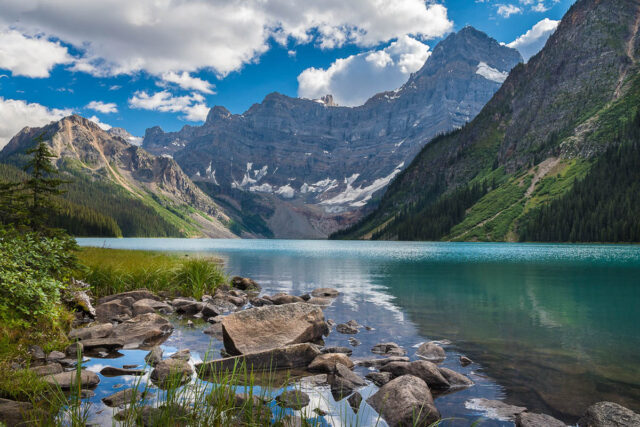
⛰️Chephren Lake (Icefields Parkway)
▻ Distance: 3.9 km / 2.42 mi one way
▻ Type: out and back
▻ Duration: 1.5 hr one way
▻ Elevation: 241 m / 790 ft
▻ Accessibility: year-round; be aware that winter may close parking areas and require additional hiking
▻ Trailhead: Mistaya River footbridge at the rear of Waterfowl Lakes Campground
Click here for trail map
The Chephren Lake hike promises breathtaking meadows and magnificent views of Mt. Chephren and Howse Peak, along with possible wildlife encounters if you are cautious!
Prepare for some challenges along the muddy trail with exposed roots, but the stunning rewards certainly make it worthwhile.
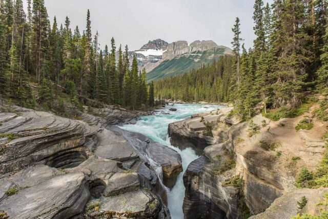
⛰️Mistaya Canyon (Icefields Parkway)
▻ Distance: 1.8 km / 1.1 mi
▻ Type: loop
▻ Duration: 40 min
▻ Elevation: 79 m / 259 ft
▻ Accessibility: year-round; use microspikes in winter as it can be icy
▻ Trailhead: Mistaya Canyon parking lot on the west side of the Icefields Parkway, precisely 5.2 km south of the David Thompson Highway junction
Click here for trail map
Mistaya Canyon is an awe-inspiring natural wonder that must be seen to be believed! This short hike in Banff promises a magnificent view of rushing water, stunning falls, and impressive rock formations.
With breathtaking scenery all around, this area is a photographer’s dream—with no need for filters!
Don’t forget to cross the bridge and walk along the river for even more views of this incredible canyon.
⛰️Panther Falls (Icefields Parkway)
▻ Distance: 0.65 km / 0.4 mi one way
▻ Type: out and back
▻ Duration: 15 min one way
▻ Elevation: 75 m / 246 ft
▻ Accessibility: year-round
▻ Trailhead: Panther Falls parking lot, located after the landmark known as “the big bend”
Click here for trail map
Experience the magnificence of nature on this short trail leading to the stunning 66 m (216 ft) waterfall. Stand right at the edge of the water while taking in the delightful sounds of rushing water.
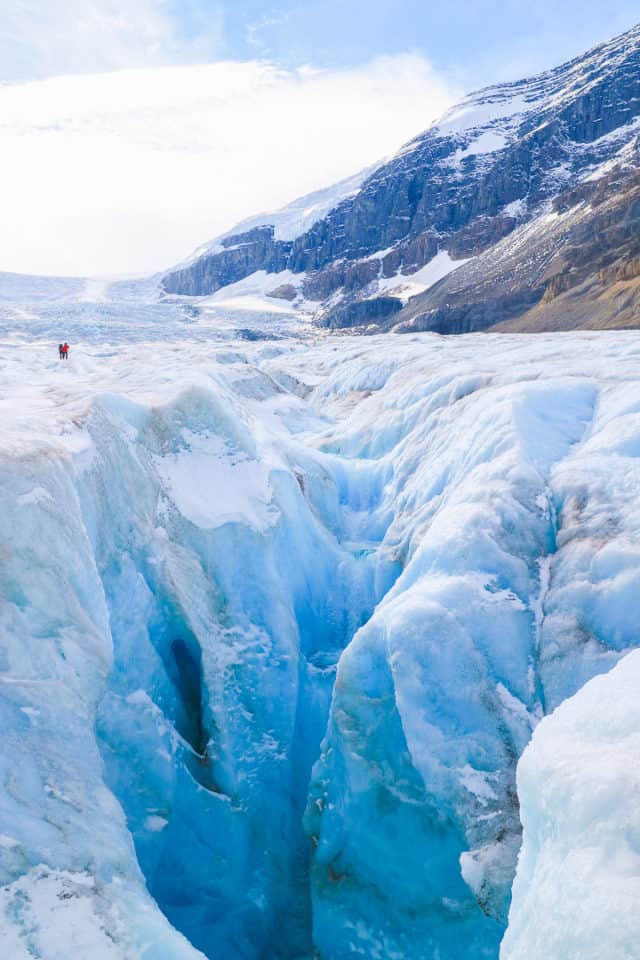
⛰️Toe of the Athabasca Glacier (Icefields Parkway)
▻ Distance: 0.7 km / 0.43 mi one way
▻ Type: out and back
▻ Duration: 15 min one way
▻ Elevation: 61 m / 200 ft
▻ Accessibility: year-round; note that the visitor center is closed and tours do not operate in winter
▻ Trailhead: Toe of the Athabasca Glacier parking lot
Click here for trail map
No adventure through the Canadian Rockies is complete without a visit to the Athabasca Glacier, especially if you’re extending your journey to Jasper National Park.
This magnificent glacier, one of Canada’s most distinguished natural wonders, is easily accessible for hikers of all skill levels.
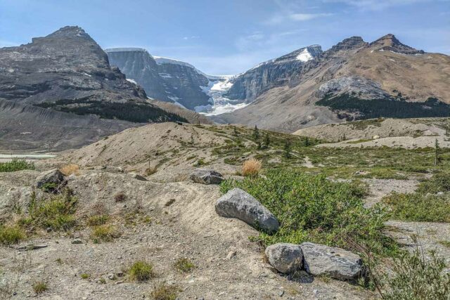
While exploring, you’ll find markers that illustrate the significant impact humans have had on the environment and the glacier’s retreat over time. It’s both a beautiful and humbling sight—an experience to cherish.
If you want to walk on a glacier, we recommend booking an Athabasca Glacier Icewalk with a local guide. You’ll have more time to observe the sights and sounds of this natural phenomenon while feeling secure in the hands of an expert.
Map of the Best Hikes in Banff
To get a clearer idea of where these trails are situated, you can make use of the Google Maps embedded below. All the easy hikes in Banff mentioned earlier are conveniently mapped out for you.
Best Time to Go Hiking in Banff National Park
Wondering when to hit the easy hiking trails in Banff? While some trails are accessible year-round, the prime hiking season in Banff National Park is from July to mid-September.
Until late June, many trails remain snow-covered and can pose avalanche risks. During this time, lower elevation trails and south-facing slopes around the Town of Banff are more suitable as they tend to be drier.
By mid-July, most alpine

