

Embark on a wilderness adventure along Meadow Lake and Dog Creek Roads, traveling from Clinton to Williams Lake. This route takes you through dusty roads, historic ranches, impressive volcanic cliffs, deep canyons, hoodoos, and even a World War II aerodrome.
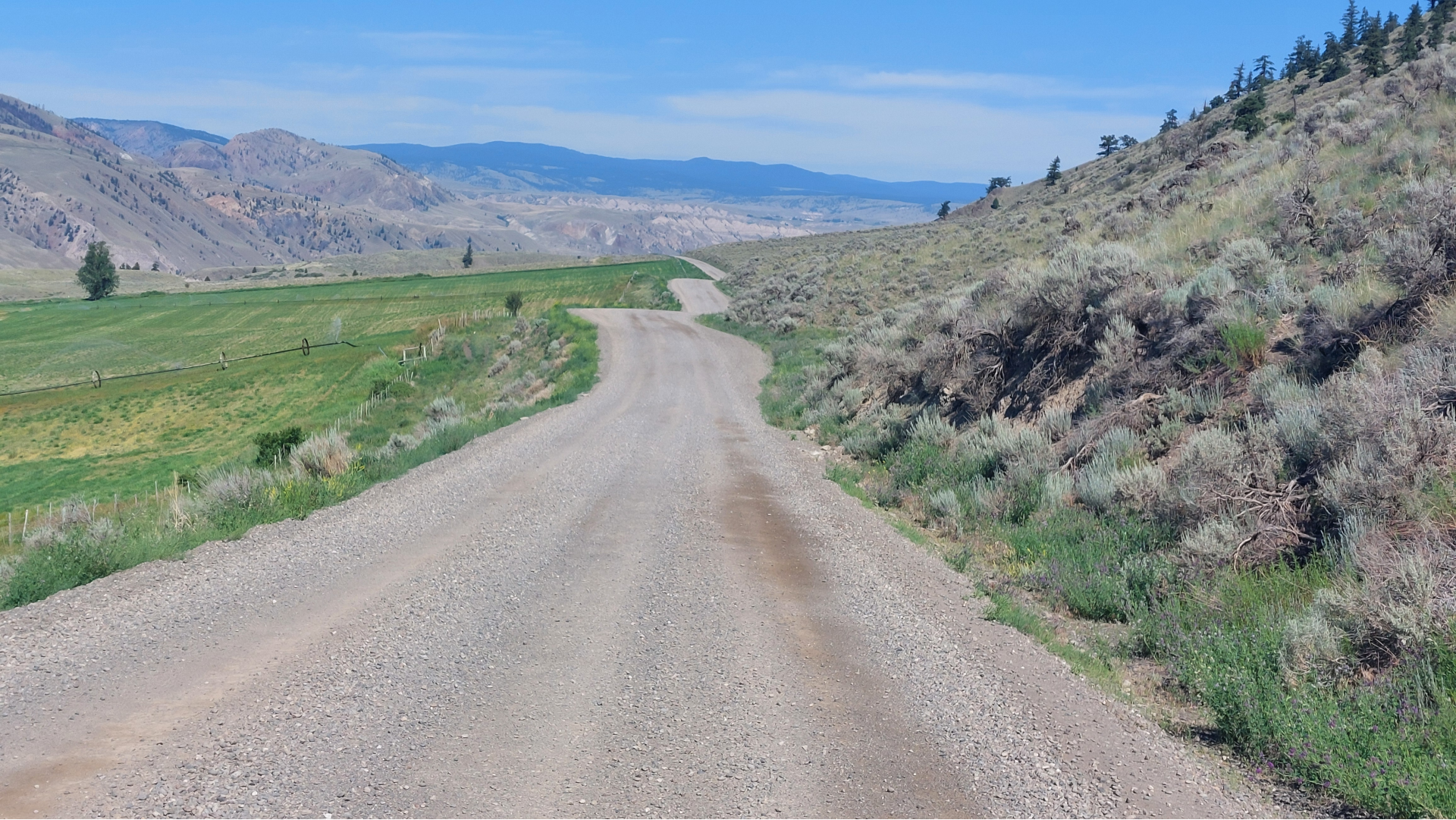
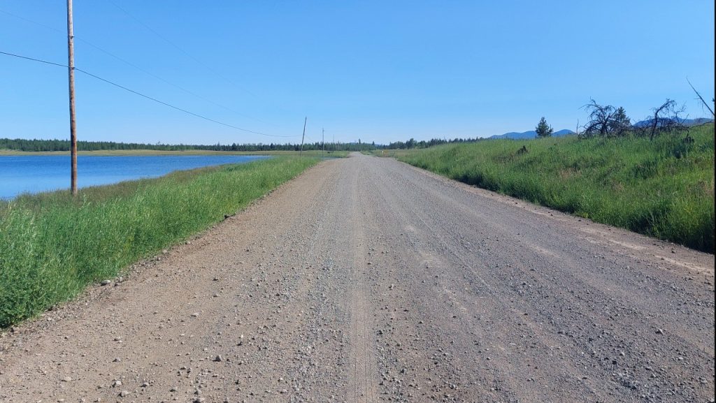
If you seek an alternative to Highway 97 while journeying from Clinton to Williams Lake, consider the scenic Meadow Lake Road to Dog Creek Road. Predominantly composed of gravel, this road features steep grades and sharp curves. The drive transitions through lush forests and steep mountains to arid deserts with deep river canyons, expansive plateaus, and rolling grasslands dotted with wetlands.
Exploring the Backroad from Clinton to Williams Lake, British Columbia
Route Overview
Camping Information
Route Map
Please note that destination markings on the map are approximate, as are the directions and distances provided in this article. We recommend plotting your route and planning accordingly.
Getting to Clinton, British Columbia
- From Vancouver: Take the Trans-Canada Hwy 1 through Hope, then head north to Cache Creek, BC. Continue north on BC-97 to reach Clinton.
- From Kamloops: Drive west on Trans-Canada Hwy 1 to Cache Creek, then make a sharp right turn onto BC-97 northbound. Continue north on BC-97 until you reach Clinton.
Preparation Tips
- Plan your road trip carefully for an enjoyable wilderness experience.
- Check your vehicle, and make sure to fill up your gas tank and water jug before departing from Clinton.
- Bring a spare tire and the necessary equipment in case of a flat tire.
- A GPS and a reliable map are essential for this journey; the Cariboo Chilcotin Mapbook is an excellent resource.
- Do not rely on cell service during your trip.
- A satellite phone or a spot communicator can be vital in emergencies.
Starting Point on Highway 97
The Meadow Lake Road begins about 17 km north of Clinton, British Columbia, along Highway 97, which heads northwest. I found myself enjoying the road all to myself. The path had recently been graded and was in great condition. However, taking this backcountry route during wet weather or in winter could present challenges. The sky was a vibrant blue as I set out from Clinton on a scorching July day.
Camping at Beaverdam Lake
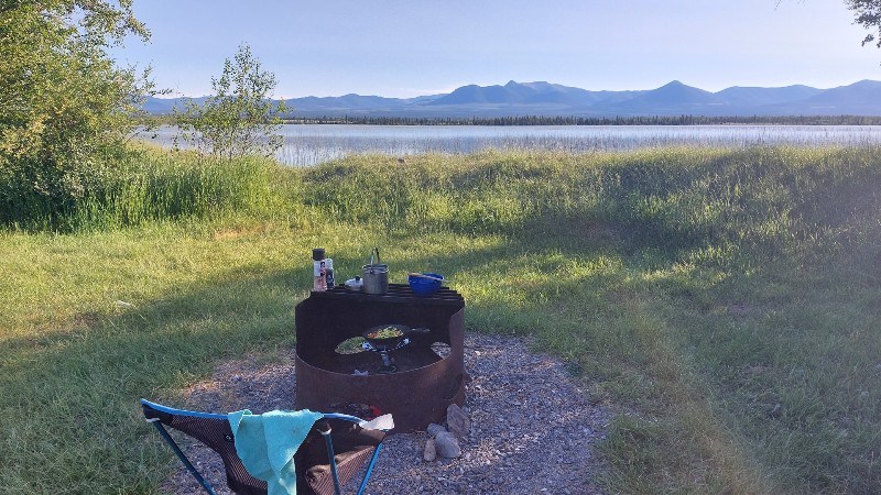
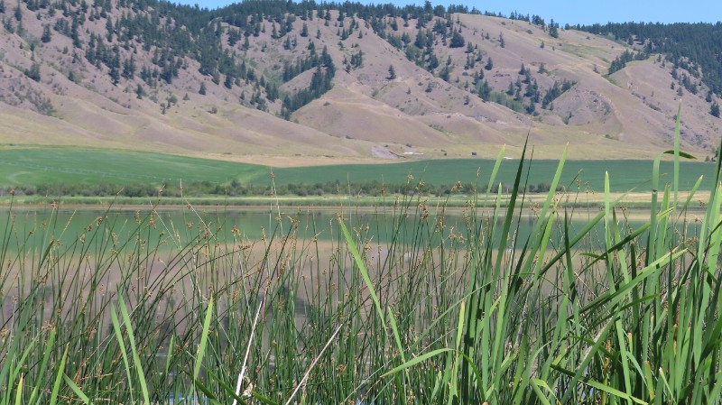
My first stop was at the BC Recreation Site by Beaverdam Lake, located 10 km from Highway 97. This expansive grassy area offers stunning views of the mountains across the lake. It features eight tables, firepits, and an outhouse, but no other amenities, and camping is free. During my visit, only two campsites were occupied.
I prepared a stir-fry on my portable one-burner camp stove to use up my vegetables before the heat spoiled them. Unfortunately, I don’t have a plug-in cooler.
With the wind blowing, I used the firepit to shield the stove from the gusts. By 10 PM, the wind had calmed and the sun dipped below the hills.
Mosquitoes
Surprisingly, I wasn’t bothered by mosquitoes despite being right by the water. Many often ask how I cope with these pesky insects. First off, I’m quite accustomed to their presence, so it doesn’t faze me. I limit my sugar intake, take Vitamin B12 and garlic, which seem to help deter them. Citrus fruits are also known to repel mosquitoes.
At night, I hang netting over my car windows to keep them out and wear long pants, shirts, or a mosquito jacket when outside. Bringing mosquito coils and bug spray is essential,, and the sun and wind are great defenses. Don’t let mosquitoes ruin your trip!
Important Note for Campers!
Please pack out all your trash, including used toilet paper if you need to relieve yourself in the grassy areas or bushes. Carry small plastic bags to collect trash behind you, ensuring these beautiful places remain pristine for others to enjoy. Regrettably, I often encounter litter, including toilet paper, scattered even near outhouses.
The Next Day: Continuation of the Wild Journey
The temperature began to rise as I stepped out of my RAV4 after a refreshing night’s sleep. Following my usual morning camp routine, I hit the road early. The route continues northwest, passing Alberta Lake around km 20 to my right.
At the km 25 junction, I kept straight on Meadow Lake Road. I noticed Meadow Lake to my left around km 27 and passed White Lake on my left near km 36.
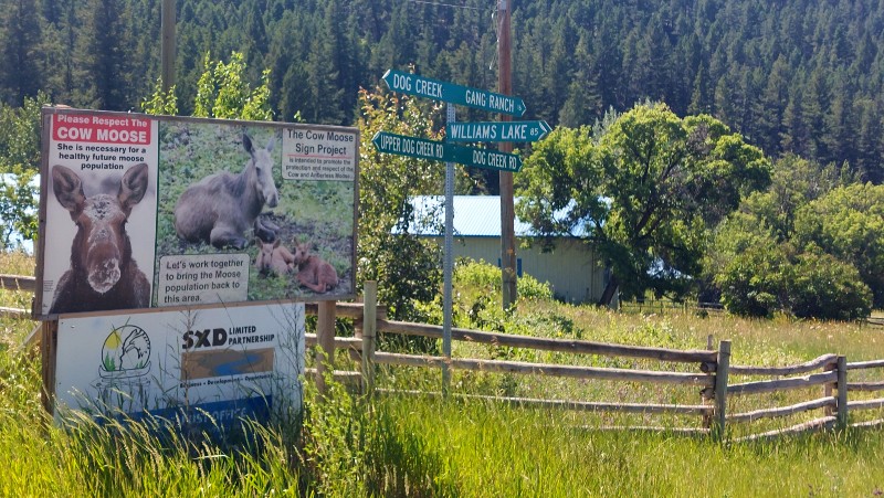
A major junction near km 39 directed me towards Canoe Creek and Gang Ranch. The right road leads to Dog Creek and connects with Enterprise Road back to Highway 97, with Long Lake on the left at km 42. Further along, I came across a significant powerline transmission corridor.
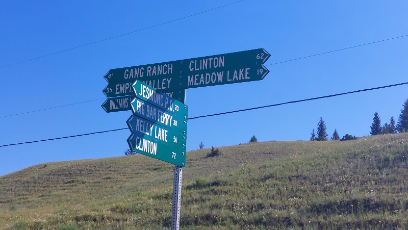
By km 45, a signpost at the junction provided much-needed information. Heading northwest takes you to Gang Ranch (41 km) or Empire Valley (55 km), while southeast leads to Meadow Lake (19 km) and Clinton (62 km). Traveling south will take you to Jesmond Post Office (20 km), Big Bar Ferry (39 km), Kelly Lake (59 km), and Clinton (72 km).
Canoe Creek Road: My Moment of Getting Lost
Near km 60, in the Canoe Creek community, I stopped to ask a man working in the field for directions. He advised me to keep going straight up the hill on Dog Creek/Canoe Creek Road. Although it’s all First Nations land with signs indicating private property, the road is open to the public.
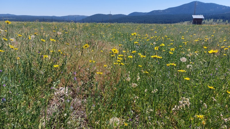
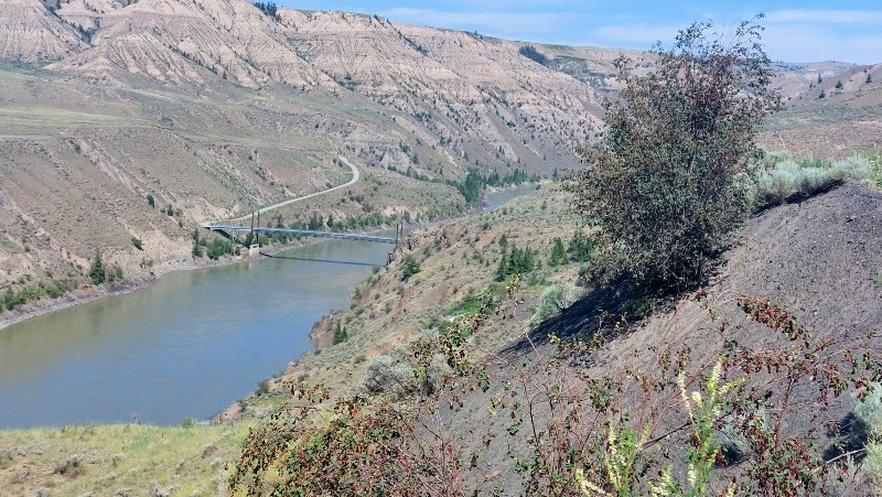
As I moved along, I entered the stunning grassland landscapes of the Fraser River, with breathtaking panoramic views at km 65 showcasing the vast expanse of the Gang Ranch cattle country, stretching as far as the eye could see. The land was covered with sagebrush and prickly pear cacti, and I could almost sense the sweet fragrance of wet sage after rain.
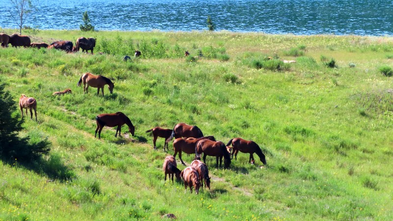
This rugged, semi-desert terrain at the confluence of the Chilcotin and Fraser Rivers serves as an essential wildlife sanctuary. I traversed through landscapes marked by wind-carved hoodoos, deep canyons, and clusters of sagebrush, scrub pine, and Douglas fir, home to California bighorn sheep.
Gang Ranch and Empire Valley Junction
At km 79, a steep road along the canyon leads down to a suspension bridge crossing the Fraser River, the primary access point to the famous Gang Ranch.
Established in 1883 by Thaddeus Harper, the Gang Ranch has a storied history, with Harper and his brother Jerome arriving during the early gold rush, driving cattle from the United States. Jerome Harper’s JH brand is one of the oldest still in use today in British Columbia. There are numerous books detailing the tumultuous history of the Gang Ranch. You can read more about it here.
I decided to skip the detour to Gang Ranch and Empire Valley and instead continued on the road to Williams Lake. The path, cut into the canyon’s side, features hairpin turns, each revealing increasingly spectacular views. The dusty trail crosses cattle guards and meanders northward, bordered by red lava cliffs formed countless centuries ago.
A Pleasant Surprise
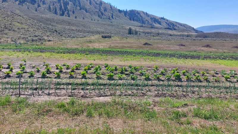
As I drove through the barren landscape, I was shocked to see a large vegetable garden to my right and stopped suddenly.
Three people were bent over, tending to the plants. A friendly First Nations woman, named Joy, approached the fence and introduced herself. She shared information about the onions and chard they grow for the Williams Lake Farmers Market, which requires a long drive every Friday to reach. Joy kindly offered me a bunch of green onions and a few chard leaves to take with me.
Dog Creek
The dusty river trail began to descend, revealing lush green fields below. The contrast to the earlier arid landscape was remarkable. Arriving at Dog Creek (km 87), I enjoyed the vibrant scenery of plateaus, valleys, fertile fields, and ranching areas.
North of Dog Creek Valley, massive volcanic boulders marked the landscape. The road continued its ascent above the Fraser Canyon, where ditches in a field indicated the historic site of the Second World War RCAF Aerodrome at Dog Creek, established as a defensive measure in case of a Japanese attack on the BC coast.
Before long, the road veered off from the Fraser River to follow Alkali Creek upstream.
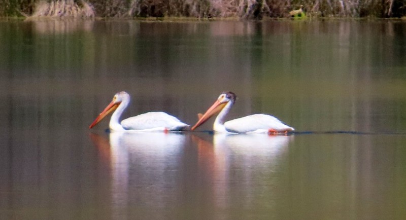
Riedermann Wildlife Sanctuary
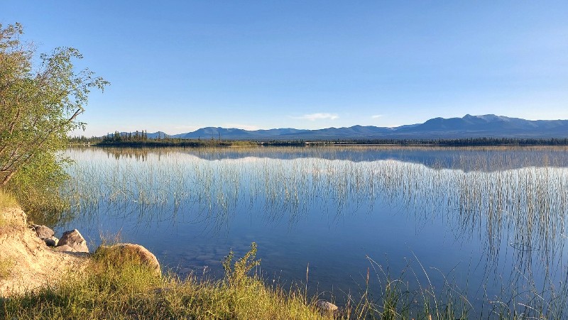
The Riedermann Wildlife Sanctuary at Alkali Lake (km 118) was established to safeguard the nesting grounds of white pelicans. While stopping by the lake, I saw three pelicans gliding along the shore. An older local man on an ATV, searching for berries, struck up a brief friendly conversation with me before I continued my journey.
Alkali Lake Ranch
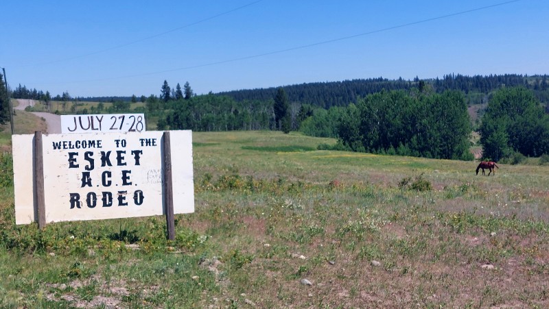
A short distance past the marshy Alkali Lake, I spotted the red building of Alkali Lake Ranch, established in 1858. This ranch claims to be the oldest in British Columbia and served as a roadhouse for travelers during the gold rush era.
I didn’t stop at the ranch but later learned they have a store where I could have browsed for more information about the area and the Esket Rodeo.
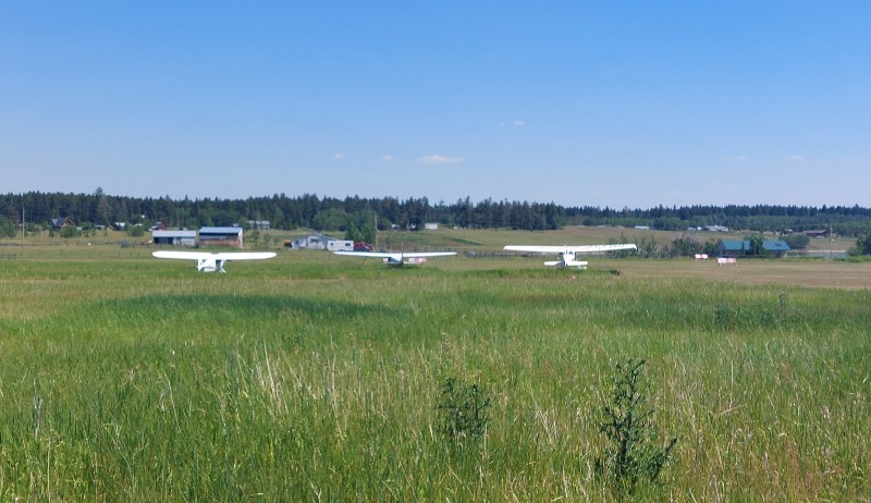
Spring House
Halfway between Alkali Lake village and Williams Lake, I drove through the small community of Springhouse, which featured a small airstrip, a float plane base, and paved roads, signaling my return to modern civilization after leaving Clinton.
Chimney Lake Road Side Trip
Chimney Lake Road (km 160) appeared to be a worthwhile detour with several recreation sites. I stopped at the Forest Service Recreation Sites at Brunson Lake (4 km to the south), Felker Lake, and Chimney Lake (19 km). However, these sites were quite crowded, which was to be expected, given their proximity to Williams Lake.
Chimney Lake Road continues south to Enterprise Road, leading back to Highway 97 shortly. I decided to turn back and continue on Dog Creek Road.
The Final Stretch
At the junction of Dog Creek Road and Highway 20, the road branches east towards Williams Lake, just 2.5 km from Highway 97. To the west, you’ll approach the beginning of the road to Bella Coola.
The sights of Williams Lake come into view as I descended towards the junction of Dog Creek Road and Highway 20. Head west for the road to Bella Coola or east to enter the heart of Williams Lake.
Arriving at Williams Lake
Williams Lake marks the conclusion of the Meadow Lake to Dog Creek backroad adventure. Be sure to visit the incredible Tourism Discovery Centre located at the city’s south entrance to discover what Williams Lake and the surrounding region have to offer. You may also find my road trip collection interesting.
This website contains affiliate links. At no extra cost to you, I earn a commission if you make a purchase. I only recommend products and companies I trust, and the earnings help maintain this site. Thank you for your support!
Additional Resources

Yrene Dee
Yrene resides in the Okanagan region of British Columbia, Canada, and is the founder of BackcountryCanadaTravel.com. Originally from Switzerland, she has lived and worked across different continents. She is an entrepreneur, a wilderness enthusiast, and an animal lover who favors off-the-beaten-path destinations. Yrene writes about her passions, primarily.

