

Matanzas State Forest is situated in a rural area just south of St. Augustine and is part of the Northeast Florida Blueway project.
This forest preserves a variety of delicate habitats along the Tolomato and Matanzas rivers through a collection of conservation lands.
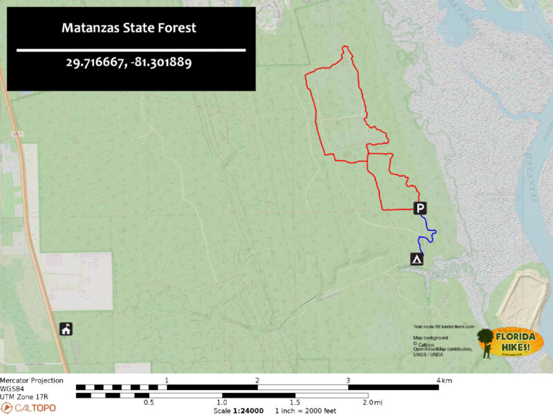
The forest features three trails that are included in the State Forest Trailwalker program: the Cedar Creek, Loop, and Hammock Trails.
In addition to the trail network, there are primitive campsites located under a shaded canopy alongside Cedar Creek, which is a small tributary that flows into the Matanzas River.
Yellow-blazed trail through pines
Resources
Overview
Location: St. Augustine
Length: 3.9 miles
Trailhead: 29.728639, -81.261500
Address: 6840 US 1 South, St. Augustine
Fees: $2 per vehicle
Restrooms: None
Land manager: Florida State Forests
Phone: 904-797-5073
The forest is open from sunrise to sunset, and leashed dogs are welcome.
Be aware that seasonal hunting takes place in Matanzas State Forest, so make sure to check the hunting dates beforehand. It’s advisable to wear bright orange during your hike if it coincides with hunting activities.
Reservations are required for campsites at Cedar Creek Campground, which can be accessed by vehicle via the forest roads.
Directions
To reach the forest, take the SR 206 exit off Interstate 95 and head east for 2.1 miles. Make a right onto US 1, and after 2.9 miles, turn left onto Double Gate Rd. In about 200 feet, turn left into a large parking area where a kiosk provides information on how to obtain a permit to enter the forest. Use the lock combination provided with your permit to open the gate next to the parking area. Continue along Double Gate Rd for 1.3 miles, then turn left onto Longleaf Rd. After 0.4 miles, turn right onto Evans Grade Rd and continue for 1.3 miles until reaching the end of the road.
Hike
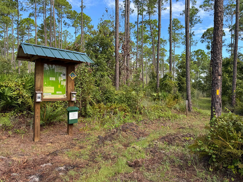
Before beginning your hike, stop by the trailhead kiosk to collect a paper map and sign in.
From the kiosk, follow the yellow markers along a grassy path bordered by ferns, bay trees, and cabbage palms.
Flatwoods Loop & Hammock Trailhead
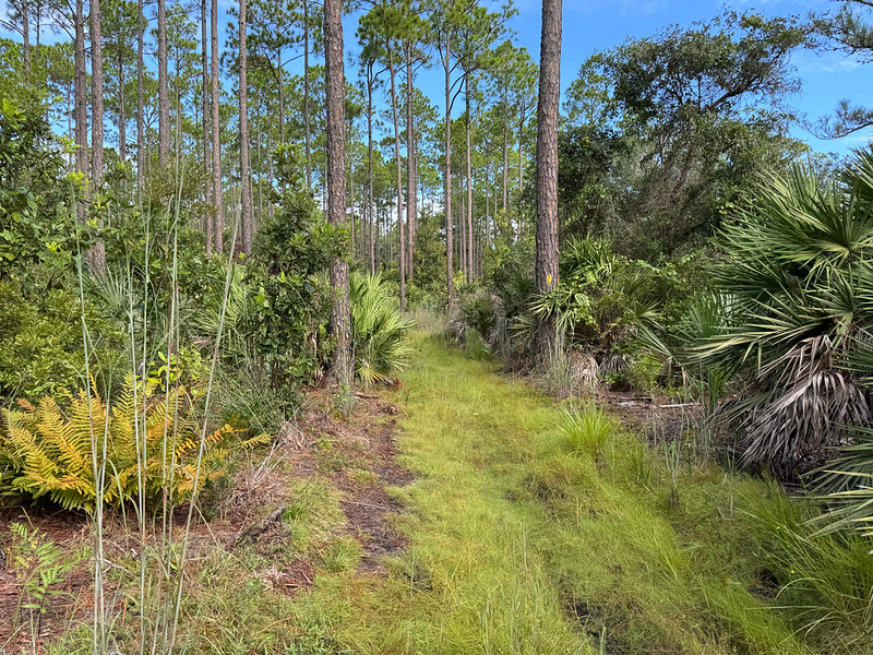
The terrain can be uneven and wet in some areas as you navigate around the edge of a former pine plantation leading to tidal salt marshes.
After a quarter mile, the path runs alongside dense oak hammocks before reaching the loop trail junction at 0.7 mile.
Yellow blazed path near the salt marsh
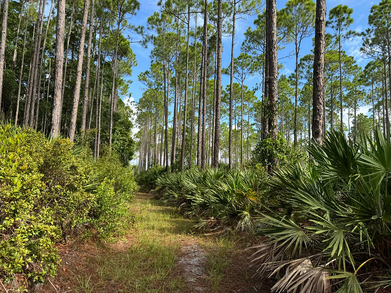
At the trail junction, turn left and follow the red blazed posts for a brief distance south on a forest road before making a sharp right to enter a wide area of mesic flatwoods.
This grassy corridor is flanked by saw palmettos, gallberry, and wax myrtles, leading to a basin swamp where the trail then turns northward.
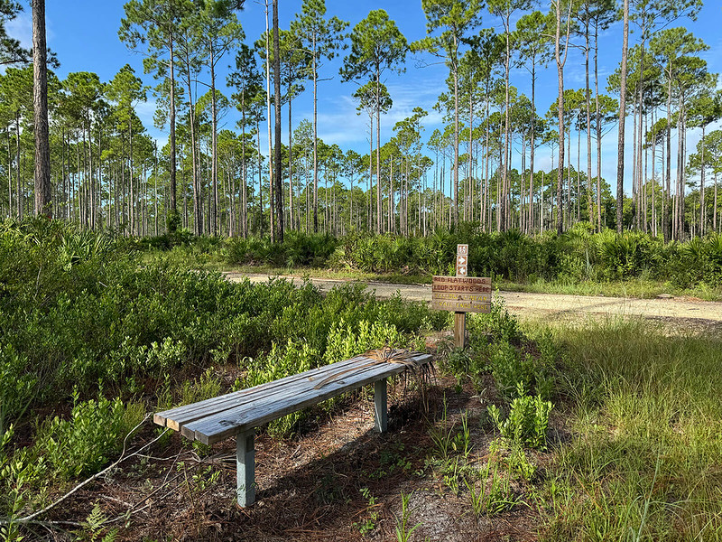
Bench at the trail junction
This low-lying wetland, situated at the base of a relict dune ridge, retains water for extended periods, creating a suitable habitat for bay and cypress trees.
The trail continues alongside the swamp before turning eastward at the 1.7-mile mark.
Trail winding alongside the basin swamp
At the northeast corner of the loop, marked by red blazes at 2.1 miles, you’ll pass a sign for the group campground and a map kiosk. The trail leads back into the woods where an oak hammock meets the flatwoods.
Gnarled oaks draped in Spanish moss arch over the path to your left, contrasting with the tall pines on your right.
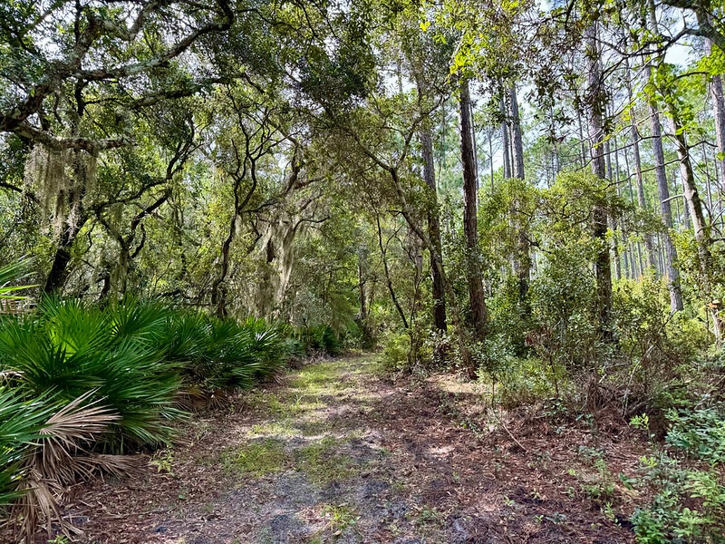
Edge of an oak hammock
At 3.2 miles, the trail emerges onto a forest road shortly before the loop concludes at the junction with the Hammock Trail.
From this point, hikers can either turn left to follow the yellow blazes or continue along forest roads back to the trailhead, which is a 0.7 mile trip regardless of the chosen route.
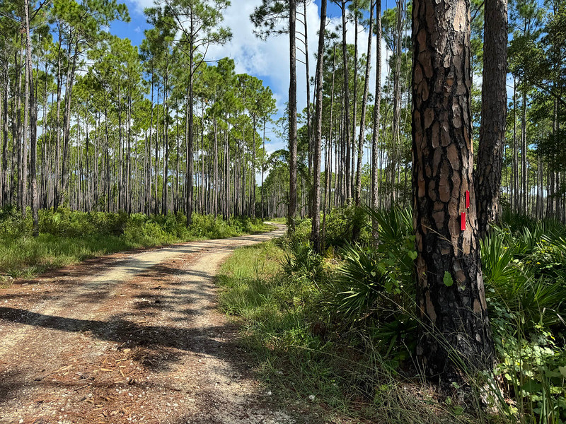
Forest road route
From the trailhead, follow the blue blazes southward for 0.6 miles along the Cedar Creek Trail, which ends at a kiosk next to the Cedar Creek Campground.
This rustic camping area, located alongside the tidal creek, features four tent sites equipped with picnic tables and fire rings.
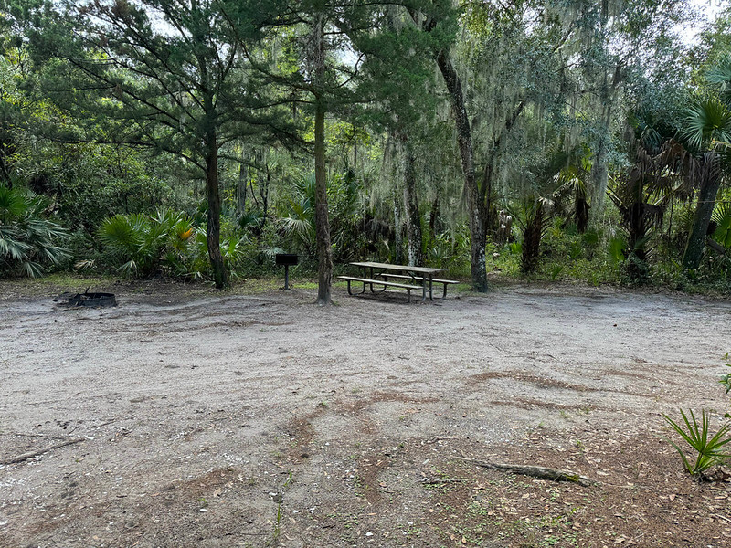
Campsite at Cedar Creek Campground
Trail Map
Explore More!
Video
Check out the video on hiking in Matanzas State Forest below:
Nearby Adventures
Trail Map (PDF) | Hunt Dates | Reserve Campsite | Official Website

